 |
 |
 |
 |
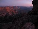
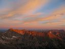
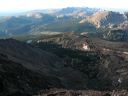
| Glacier Gorge & Continental Divide f/Keyhole |
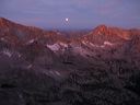
moon setting, McHenrys Peak, f/Keyhole |
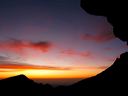
Mt Lady Washington at dawn f/Keyhole |
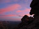
looking back to The Keyhole |
 |
 |
 |
 |
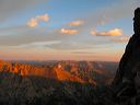
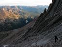
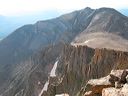
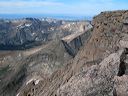
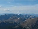
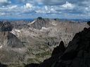
| McHenrys Peak & Continental Divide f/Keyhole route traverse |
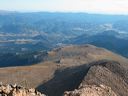
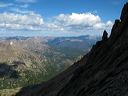
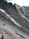
Continental Divide, looking NW, f/Keyhole route traverse |
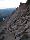
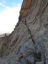
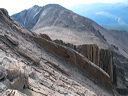
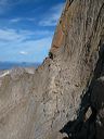
Keyhole route, west face of Longs Peak |
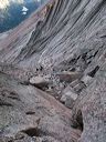
looking up The Trough |
 |
 |
 |
 |
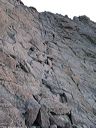
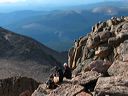
| climbing The Trough |
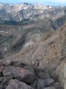
The Trough, looking down |
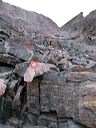
from top of the chockstone at top of Trough |
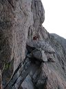
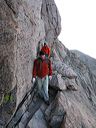
climber on The Narrows |
 |
 |
 |
 |
| climbers on The Narrows |
climbers on The Narrows |
climbers on The Homestretch |
Mount Meeker f/ The Homestretch |
 |
 |
 |
 |
| south down Homestrech, Wild Basin & Indian Peaks |
Chasm Lake, Twin Sisters Peaks |
Mount Lady Washington & Chasm Lake |
Mount Meeker & The Loft f/Longs Peak |
 |
 |
 |
 |
| Mount Meeker & The Loft f/Longs Peak |
Estes Park, Boulderfield, Mt. Lady Washington |
climbers on summit, looking down on The Loft |
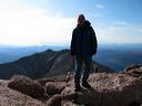
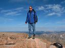
Mark on Longs Peak summit looking SE |
 |
 |
 |
 |
| Mark on Longs Peak summit looking WNW |
south face of Longs Peak from summit looking SW |
Mount Meeker, The Loft, The Homestretch |
The Homestretch, The Palisades, & Wild Basin |
 |
 |
 |
 |
| Indian Peaks from Longs Peak |
Indian Peaks, Continental Divide, & Wild Basin |
climbers on The Homestretch, looking down f/summit |
climbers on The Narrows |
 |
 |
 |
 |
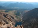
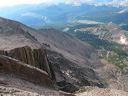
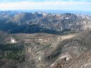
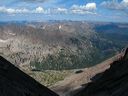
| Glacier Gorge from The Trough |
Glacier Gorge from The Trough |
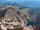
McHenrys Peak from Keyhole route traverse |
McHenrys Peak & Continenal Divide f/Keyhole route traverse |
 |
 |
 |
 |
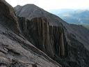
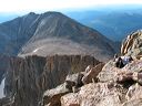
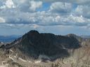
| The Trough, Pagoda Mountain & Isolation Peak |
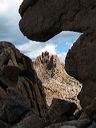
Storm Peak, through The Keyhole |
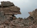
Agnes Vaille Shelter at The Keyhole |
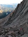
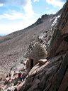
climber beginning traverse from The Keyhole |
 |
 |
 |
 |
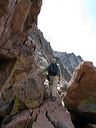
| climbers at The Keyhole |
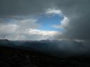
storm abating, f/below The Boulderfield |
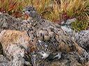
Ptarmigan camouflage |
Ptarmigan |